|
The
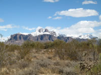
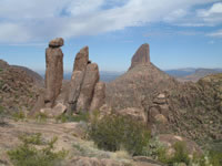
Superstition Mountains are a volcanic range with many rough
canyons and peaks. Weavers Needle, a volcanic chimney, is
perhaps the best known as the landmark in the various legends of
the Dutchman's lost mine.
The
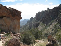
Superstition Range contains the Superstition Wilderness area
as well as various lakes and numerous hiking trails. It is
a favorite destination for many horseback riders, hikers,
and boaters since the trails and lakes are convenient to the
Phoenix Metro area. Favorites for hikers include the Peralta
Trail (Weaver's Needle viewpoint from Freemont Saddle), Hieroglyphic Canyon, Lost Dutchman State Park, Wind Cave,
Fish Creek, and more sites.
The
Apache Trail runs along the north side of the Range. It follows
Canyon and Apache lakes to Roosevelt Dam. Elevations in the
Superstitions vary from 2,000-6,000 ft. The terrain in parts
can be very unforgiving. Hieroglyph
Canyon and Tonto National Monument are close by.
Location: About 40 miles east of Phoenix. The Apache trail traverses
it and US 60 passes to the south.
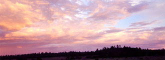
Climate: This is desert. Summer temperatures easily exceed 100 degrees Fahrenheit.
Hikers should carry plenty of water and be prepared for conditions.
|