| Chiricahua National Monument is located in Southeastern Arizona. The
Apaches knew this area as 'the land of Standing-Up
Rocks' — a very appropriate name for the area. The Monument's primary
attractions are the spectacular eroded rock formations, unique
wildlife, and its isolation.
In the 1800s, the Chiricahua Mountains were the home of the Chiricahua
Apaches. Cochise and Geronimo operated out of these mountains.
Warfare and conflict were common in the area until the late
1800s. Years later, Ed and Lillian Riggs built a small ranch
and began exploring the area. In 1922, they showed photographs
of the rock formations at a fair and began promoting the idea
of a national park. The area became a national monument two
years later in 1924.
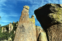
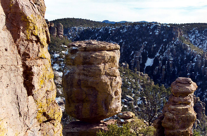
The spectacular rock formations were formed when
the Turkey Creek Volcano erupted and sent gas, pumice, and
ash into the air. As the ash settled, the hot layers melted
together and formed a gray rock called Rhyolite canyon Tuff.
As it cooled, it contracted, cracked, and formed joints. Ice
and frost enlarged these joints when water seeped into them,
froze and expanded. Over time, erosion and other natural forces
took their toll and formed the existing spectacular rock formations.
The Chiricahuas are unique in many different ways. They lie
at the confluence of the Sierra Madre, Sonoran Desert, Chihuahuan
Desert, and the Rocky Mountains. Flora and fauna here include
Englemann Spruce, Chiricahua Pine, Apache Pine, Pinyons, Alligator
Juniper, Oaks, Manzanita, Sotol, Trogons, Mexican Jays, Coatimundis,
Spotted Owls, various hummingbirds, ocelots, and jaguarundis.
It is rumored that jaguars and parrots are occasional visitors.
Although parrots disappeared from the Chiricahuas some time ago,
efforts are being made to reintroduce them to the area.
Visitors
today enjoy hiking, birding, spectacular scenery, and incredible
rock formations. Camping and picnic sites are also available.
Trails
in the area include the Echo Canyon Trail, Massai Point Nature
Trail, Heart of Rocks Trail/Loop, Sugarloaf Mountain Trail,
Hailstone Trail, and a 2.4 mile trail to a natural bridge.
The Faraway Ranch and Stafford Cabin are also found in the
monument.
It is possible to hike from the top (Massai point) to the visitor's
center. Check at the visitor's center for more information.
Location: Southeast of Tucson, From Tucson, drive to Willcox. From Willcox,
head south to the monument.
Please note, this is an isolated section of Arizona. There
are no hotels or gas available in the Monument. These can
be found in nearby communities. Visitors should be prepared
for conditions.
Climate: Several ecosystems meet here. Summer temperatures can easily exceed
100 degrees Fahrenheit. Winter temperatures can be very cold, and snow
is common during the winter months. Hikers should carry plenty of
water and be prepared for conditions.
|